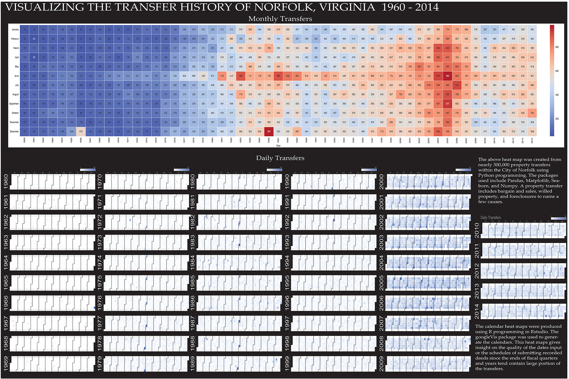
Data Science Advisor | Geospatial Analytics & MLOps Expert
10+ years transforming spatial data into actionable insights
400% Model Improvement $800B NYC Property Valuations 110M+ Addresses Geocoded
Data Science Advisor at Cigna Healthcare/Evernorth with 10+ years of expertise in geospatial analysis and machine learning. Proven track record of implementing ML models that improved business metrics by up to 400%, managing $800+ billion in NYC property valuations, and processing 110+ million addresses through sophisticated geocoding pipelines.
Currently leading MLOps and geospatial data science initiatives, I specialize in developing enterprise-wide standards for model optimization, monitoring, evaluation, and equity governance. My work bridges the gap between geographic information science and modern data science, with particular expertise in spatial econometrics, healthcare analytics, and property valuation modeling.
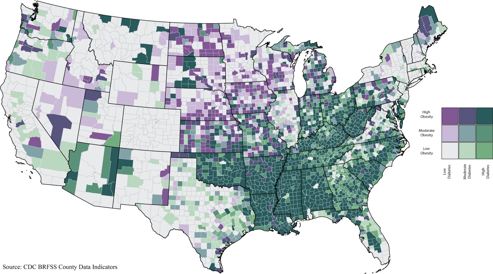
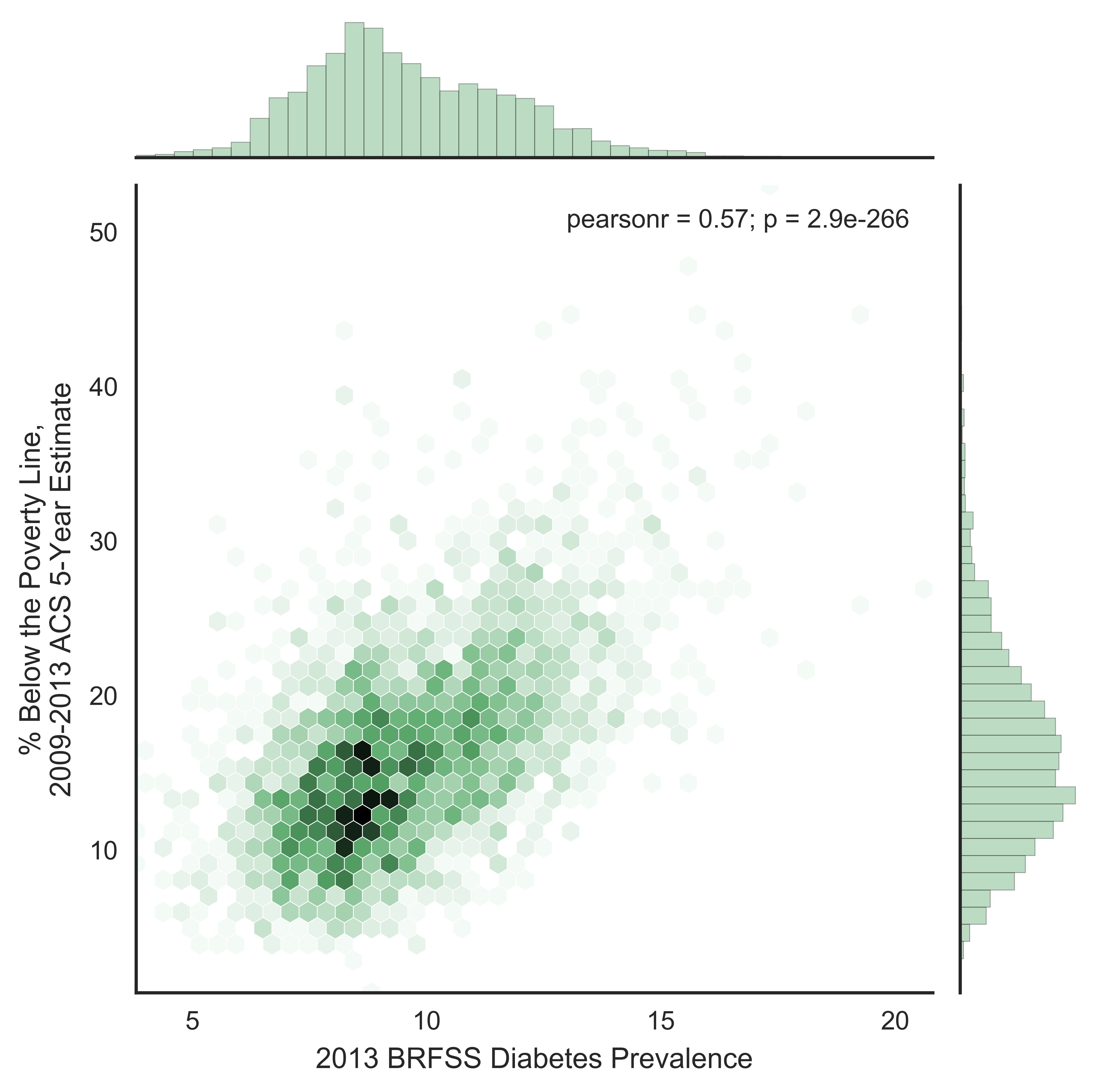
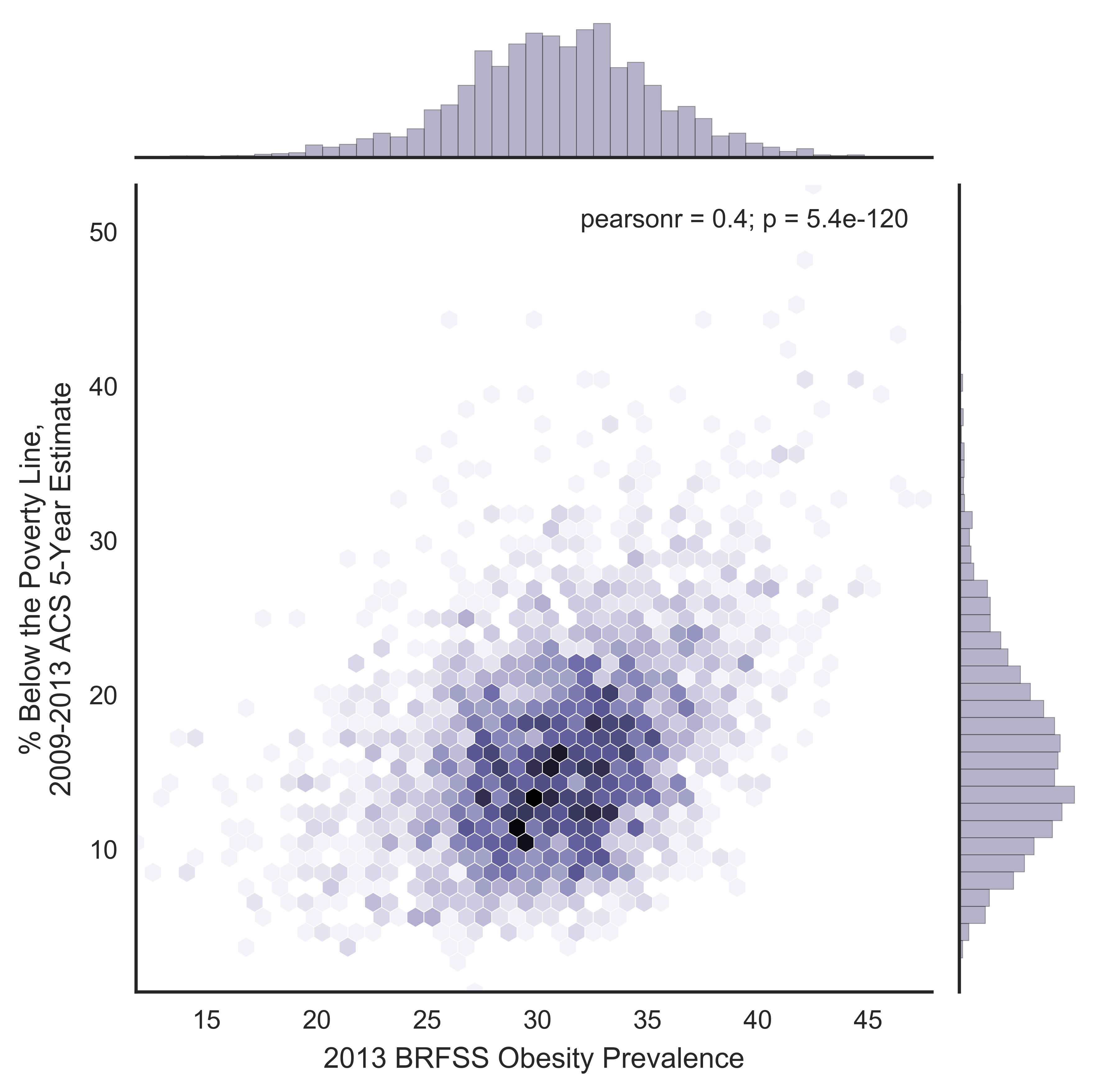
Advanced proficiency in Python, R, SQL, and GIS technologies, with published research in spatial epidemiology and population health analytics. Graduate degrees in Geography from University of Alabama and University of Tennessee, plus GISP certification.
Core Competencies: MLOps • Spatial Econometrics • Healthcare Analytics • Property Valuation • Machine Learning • Social Determinants of Health • Model Governance • Python/R/SQL • GIS & Cartography
Addresses Geocoded
Years of Experience
Property Portfolio Valued
Model Performance Improvement
Lead enterprise-wide ML model optimization, monitoring, and evaluation standards. Enhanced national social determinants of health model performance by 400%. Developed Python automation frameworks for bias testing, streamlining manual processes. Expertise in scalable ML pipelines for healthcare analytics and population health assessment.
Developed and implemented spatial econometric models to assess $800+ billion in NYC property values across residential, commercial, and mixed-use properties. Led research initiatives on spatial machine learning applications. Expert in property value driver analysis, sales trends modeling, and market analysis using R, SAS, and SQL.
Led large-scale spatial health research projects on diabetes, rural health, obesity, and emergency medicine at NYU Langone Health. Geocoded 110+ million addresses from SPARCS database. Created data visualizations for Hurricane Sandy cardiac impact studies. Published research in spatial epidemiology and population health analytics.
Python & MLOps
AdvancedR & Spatial Stats
AdvancedGIS & Cartography
AdvancedSQL & SAS
Advanced
Comparing methods of performing geographically targeted rural health surveillance
Research comparing methodologies for rural health surveillance using spatial analysis techniques and geographic targeting approaches.
Age Disparities Among Patients With Type 2 Diabetes and Associated Rates of Hospital Use and Diabetic Complications
Analysis of age-related disparities in diabetes outcomes and healthcare utilization patterns using large-scale health data.
Identifying Geographic Disparities in Diabetes Prevalence Among Adults and Children Using Emergency Claims Data
Spatial epidemiology research identifying geographic disparities in diabetes prevalence using emergency department claims data and advanced geocoding techniques.
Workshop: Intro to GIS using R
Led hands-on workshop teaching geospatial analysis using R and open-source GIS tools to conference attendees.
Refining GIS/CAMA Data Quality and Visualization with Python
Presented innovative Python automation approaches for improving Computer Assisted Mass Appraisal (CAMA) data integration with GIS systems.
Geographic Information Systems Professional
Nationally recognized certification demonstrating expertise in geographic information systems and spatial analysis.